OVERVIEW OF THE ZONE
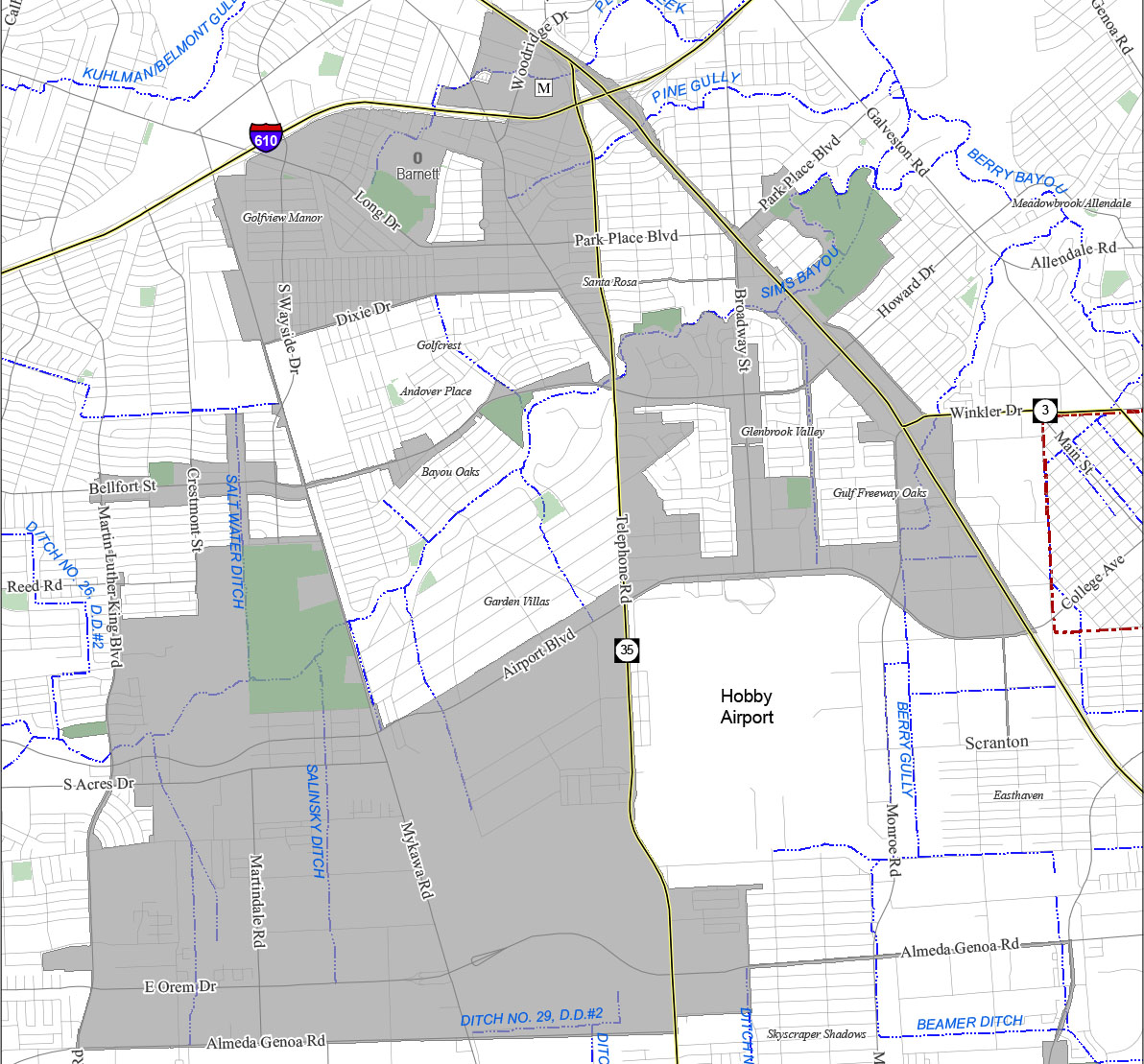
Tax Increment Reinvestment Zone No. 8, commonly called the “Gulfgate TIRZ”, was established in 1997. It expanded in 1999 for the purpose of further reinventing Gulfgate Mall and the surrounding area using tax increment from the City of Houston, Harris County and Houston ISD. Since that time the reinvestment zone has expanded south in an effort to provide the same level of successful reinvestment to other areas. Today, the Gulfgate TIRZ encompasses approximately +/- 8,463 acres and generally stretches west to Martin Luther King Boulevard, south to Almeda Genoa Road and east beyond I-45 (Gulf Freeway). The TIRZ encompasses the Houston Botanical Garden, as well as the commercial, industrial and multifamily areas along Telephone Road, Broadway Street, Bellfort Street, Mykawa Road and Airport Boulevard, and borders William P. Hobby Airport. The reinvestment zone is located in Districts D and I.
As the TIRZ has grown, so too have the number and types of projects it has undertaken. TIRZ No. 8 seeded the funding needed to complete $17 million in improvements along Broadway Street alongside numerous public and private partners – just in time for the Super Bowl. The TIRZ continues to make traffic safety and mobility enhancements throughout the zone, including improvements to Park Place Boulevard, Madden Lane and multiple smaller scale corridor projects.
The reinvestment zone has placed significant interest in the recreation and natural of the community ranging from open space to trails and parks. Trail improvements have included construction of trailheads and connectivity to the road network such as at the intersection of Sims Bayou with Telephone and Reveille Roads. A Parks Master Plan completed in 2021 in coordination with Houston Parks and Recreation Department is being implemented throughout the zone including major enhancements to Charlton Park.
Additionally, the TIRZ has recognized and begun to address the need for quality workforce housing in the area. The reinvestment zone has collaborated with the private sector through development agreements that could result in nearly 1,600 new units, including one of the first 3-D printed housing communities in Houston.
Located in southeast Houston, adjacent to Hobby Airport, TIRZ 8 functions as a means to improve the area bounded by 610, I-45 East, MLK, and Almeda Genoa. TIRZ 8 is identified by four distinct features: Nodes, Districts, Paths, and Edges, as shown below. These features were chosen to broker an understanding of the area’s unique physical layout, functionality, and individual character.
Districts are sub areas of a reinvestment zone and are largely centered around major corridors, including Mykawa Corridor, Telephone Corridor, Broadway Corridor, Bellfort Corridor, Dixie Corridor, and Long Corridor.
Paths are channels for traveling from one destination to another and create the framework for the area on which all other components fit.
- Roadways
- BNSF Railway
- Sims Bayou Trail

Nodes, or Activity Centers, are significant destinations that regularly attract people and typically include a focused concentration of land uses such as shopping areas, major parks, educational institutions, or employers in one location.
Parks:
- Cullinan Park
- Golfview Park
- Stuart Park (Outside TIRZ)
- Edgewood Park
- Law Park
- Dow Park
- Glenbrook Park
- Charlton Park
Schools:
- Thomas Middle School
- Frost Elementary School
- Sterling High School
- Mading Elementary
- Alcott Elementary
- Brookline Elementary
- Golfcrest Elementary
- Bellfort Academy
- Ortiz Middle School
- Houston Can Academy
Shopping:
- Gulfgate Mall
Work:
- Hobby Airport